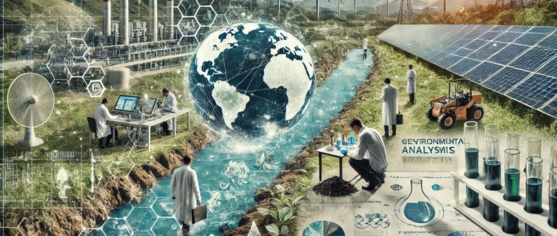
Geoenvironmental Analysis in Clean Energy Projects
Explore innovative geoenvironmental analysis methodologies in clean energy projects. Discover sustainable approaches that optimize environmental impact and enhance project efficiency for a greener future.
RENEWABLE ENERGIES
Jose Rendon
1. Introduction: The Gaze That Scrutinizes the Subsoil and the Firmament
There is a subtle thread that connects humanity's obsession with energy to our need to inhabit a planet in balance. Observing the Earth from afar, one might wonder whether we have truly deciphered the secrets hidden in its soils, valleys, and oceans. Yet, our technological advancements seem to lead us to a historical crossroads: the urgent need to transition toward clean energy production models. In this journey, geology and environmental studies play an essential role, for without proper analysis of our surroundings—surroundings that used to be invisible to many—we risk repeating past mistakes in the name of progress.
The installation of wind farms, photovoltaic plants, or geothermal systems is not free from impacts on nature and local communities. How can we intervene in landscapes without distorting their essence? How can we balance resource extraction with social justice and biodiversity conservation? This text, seeks to explore the methodologies of geoenvironmental analysis—Environmental Impact Assessments (EIA), Geographic Information Systems (GIS), remote sensing—that accompany the deployment of renewable energies.
2. The Rise of Clean Energy and the Relevance of Preliminary Studies
2.1 A Global Context Toward Decarbonization
Over the past two decades, the world has seen sustained growth in the implementation of renewable energies. According to the "Renewable Energy Statistics 2023" report by the International Renewable Energy Agency (IRENA), the global installed capacity of clean energy surpassed 3,000 GW (gigawatts) by the end of 2022—an achievement that would have been unimaginable at the end of the last century. In fact, the proportion of wind and solar energy in the global grid grows each year, putting pressure on electric systems that once depended on fossil fuels.
International commitments, such as the Paris Agreement, drive the goal of limiting global warming to well below 2°C and ideally 1.5°C. Achieving this requires drastic reductions in CO₂ emissions. In this race against time, replacing high-carbon energy sources (coal, oil, gas) with renewable alternatives is essential. However, building a wind farm atop a mountain or a solar complex in a semi-desert area demands a meticulous analysis of multiple environmental and geological factors.
2.2 Why Renewable Projects Also Need EIAs
While renewable energies are promoted as "green" and free of pollution, every infrastructure project—no matter how clean in terms of emissions—has environmental impacts that deserve evaluation. The construction of access roads, partial deforestation, habitat modification, and potential aquifer disruption are latent risks that must be addressed through rigorous methodological studies.
Environmental Impact Assessments (EIAs), together with the application of Geographic Information Systems (GIS) and remote sensing, have become key tools for anticipating and mitigating such impacts. The goal is not to hinder the energy transition but to optimize it, ensuring that the implementation of clean technologies occurs responsibly, with a holistic view of the territory.
3. Environmental Impact Assessments (EIA): The First Pillar of Planning
3.1 Fundamentals and Scope of an EIA
An Environmental Impact Assessment constitutes a detailed diagnosis of the effects a project may have on the geosphere, hydrosphere, atmosphere, biota, and human communities. This study is based on specific regulations of each country (or region) and international guidelines, such as those of the World Bank or the European Union, which mandate these analyses for large energy projects.
Generally, an EIA includes:
Project Description: Location, technology, dimensions, required resources (water, land, raw materials), workforce, duration.
Environmental Inventory: Characterization of the physical environment (geology, geomorphology, soils, water resources), biotic environment (flora, fauna, biodiversity), and socioeconomic environment (demography, economic activities, cultural heritage, traditions).
Impact Assessment: Analysis of the significance of potential impacts on each environmental component using qualitative and quantitative methodologies.
Proposed Mitigation Measures: Strategies and actions to reduce or offset negative impacts.
Environmental Monitoring Plan: Monitoring and tracking of critical parameters during the construction and operational phases.
3.2 The Challenge of Geology in EIAs for Renewables
Most clean energy projects require extensive land use for the installation of wind turbines, solar panels, or geothermal infrastructures. For example, wind platforms in mountainous regions can pose risks of erosion and ground instability if proper geotechnical evaluation is not conducted. Similarly, solar farms in arid zones may require land leveling and heavy transport access, disrupting the soil's surface layer.
According to data from consulting firm Wood Mackenzie (2022), implementing just 1 GW of solar energy can require between 3,000 and 4,000 hectares, depending on the technology and panel configuration. To avoid degradation of groundwater resources and material banks, geological EIAs must examine subsurface permeability, fault presence, and slope stability.
4. Geographic Information Systems (GIS): Mapping for Sustainability
4.1 The Power of Georeferencing
Geographic Information Systems (GIS) have revolutionized the collection, analysis, and representation of spatial data. With these digital platforms, it is possible to overlay layers of information on relief, protected species distribution, hydrology, land use, and existing infrastructure. This holistic view—akin to observing a board with interconnected pieces—is vital for renewable projects.
In practice, GIS enables:
Delineating Potential Areas for wind turbine or solar panel installations, considering solar radiation, wind intensity, and proximity to electrical grids.
Evaluating Topography and Slopes to calculate construction costs and minimize soil removal.
Identifying Potential Conflicts with protected areas, archaeological zones, water reserves, or indigenous settlements.
Planning Access and Distribution Routes, optimizing distances and reducing ecosystem fragmentation.
4.2 Real-World Project Experience
Several countries lead in using GIS for energy planning. For example, Germany and Denmark integrate these systems in defining Wind Priority Areas. Germany's Federal Institute for Geosciences and Natural Resources (BGR) maintains a georeferenced database that combines geological, environmental, and urban planning variables to identify optimal wind development sites.
In Latin America, the NGO NatureServe collaborates with local governments and multilateral agencies to map biodiversity and correlate it with potential clean energy sources. Using GIS, they have reduced the impact of projects on vulnerable ecosystems, preserving areas with high densities of endemic species.
5. Remote Sensing: Eyes in the Sky and the Electromagnetic Spectrum
5.1 The Contribution of Satellites to Environmental Analysis
Remote sensing refers to gathering surface information without direct contact, typically via satellite sensors, drones, or airborne systems. For renewable energy projects, this technology provides data on terrain morphology, vegetation cover, surface temperature, and soil moisture, among other parameters.
NASA, the European Space Agency (ESA), and other organizations offer public platforms with high-resolution satellite images, such as the Landsat or Sentinel series, widely used in prospecting and monitoring megaprojects. Satellite technology, coupled with artificial intelligence algorithms, can detect subtle changes in vegetation, erosion, or soil moisture, aiding in risk anticipation and conservation planning.
5.2 Control and Post-Installation Evaluation
Once a wind or solar farm is built, remote sensing remains relevant in the operational and monitoring phases. High-resolution satellite images can detect anomalies on panel surfaces (e.g., dust accumulation or damage), reduce manual inspection times, and optimize photovoltaic plant efficiency. Drones equipped with thermal cameras can verify the integrity of wind turbine blades and identify early signs of wear or cracks.
In geothermal energy projects, thermal remote sensing can detect surface temperature changes associated with leaks or subsurface fluid seepage. Similarly, in hydropower projects, satellite technology facilitates monitoring reservoir water levels, sediment accumulation, and surrounding vegetation health.
6. The Cultural and Social Dimension of Geoenvironmental Analyses
6.1 Beyond Pure Science: The Voice of Communities
It is essential to recognize the importance of listening to the stories, myths, and unseen realities of local populations. Geoenvironmental analysis cannot be limited to mathematical models and scientific measurements; it requires "active listening" to ancestral knowledge and understanding of social conflicts.
Many indigenous or rural communities possess an intimate knowledge of their land, passed down through generations. They can identify springs, geological faults, medicinal plants, or critical habitats not adequately recorded on official maps. Without their participation, an EIA would be incomplete, risking the invasion of sacred sites or causing irreparable harm to social cohesion.
6.2 Socioeconomic Impact Assessments
The EIA, combined with GIS tools and remote sensing, must also include detailed socioeconomic diagnostics. What productive activities will be displaced by constructing a solar plant? How can we avoid the excessive concentration of renewable projects in a single area, which might cause abrupt changes in land costs or migration flows?
One of the most notable examples is found in the high plains of Mexico, where the proliferation of large-scale wind projects has led to tensions with local communities demanding fair compensation and the preservation of cultural and ecological corridors. Often, GIS has been used not only to map existing energy infrastructure but also to locate schools, hospitals, ceremonial centers, and other community facilities that must be protected.
7. Current Trends in Geoenvironmental Analysis Methodologies
7.1 Toward the Integration of Big Data and Artificial Intelligence
In an increasingly digitized world, Artificial Intelligence (AI) and Big Data allow the processing of vast amounts of information from sensors, meteorological networks, climate records, and massive geological databases. AI can recognize patterns, anticipate risks, and propose sustainable development scenarios much faster than a team of specialists working in isolation.
Detecting anomalies in air quality, estimating regional renewable resource availability, and assessing an ecosystem's resilience to climate change are tasks enhanced by cross-referencing thousands of data points in real-time. By 2030, most large-scale environmental impact studies are expected to employ machine learning algorithms to refine decision-making during project design phases.
7.2 International Protocols and Certifications
With the rapid growth of renewable projects, international protocols and standards have emerged to promote the execution of robust geoenvironmental analysis methodologies. Some relevant certifications include:
Equator Principles Protocol: Adopted by banks and financial institutions to ensure that funded projects meet environmental and social management standards.
ISO 14001: Provides guidelines for environmental management in organizations and projects, reinforcing continuous improvement and monitoring.
IRMA (Initiative for Responsible Mining Assurance): While focused on mining, many recommendations are adapted to clean energy infrastructure projects, requiring rigorous geological and social evaluations.
Organizations like the United Nations Environment Program (UNEP) and the World Bank also issue updated guidelines on strategic environmental assessments and the need to integrate climate change scenarios into EIAs.
8. Case Studies Illustrating Methodologies
8.1 Offshore Wind Farm in the North Sea
The Hornsea One project, located off the UK coast, is one of the world's largest offshore wind farms. During its study phase, GIS was used to analyze ocean currents and marine fauna distribution, and remote sensing data was processed to calibrate wave and wind models. The EIA included the participation of local fishing communities to minimize interference with their traditional fishing areas. With over 174 turbines, Hornsea One generates around 1.2 GW of capacity, providing electricity for more than one million homes.
8.2 Large-Scale Solar Plant in the Atacama Desert
In Chile, the Atacama Desert has become a prime location for photovoltaic projects due to its high irradiation and stable climate. However, EIA and remote sensing revealed the presence of indigenous communities and the need to protect groundwater in areas of water stress. GIS was used to overlay environmental sensitivity layers, resulting in the relocation of several projects to avoid encroaching on sacred sites. By 2025, the region is expected to host more than 8 GW of installed solar capacity, providing a significant boost to the country's decarbonization efforts.
8.3 Geothermal Energy Utilization in Iceland
Iceland stands as a global leader in geothermal energy. The Hellisheiði geothermal field, which supplies heat and electricity to much of the capital, Reykjavik, exemplifies the importance of comprehensive geological characterization. Before drilling deep wells, geophysical studies, 3D modeling, and seismic risk assessments were conducted. Using GIS and remote sensing, engineers mapped the distribution of geological fractures and thermal waters. This project now supplies energy to over 100,000 homes and significantly reduces the country's carbon footprint, demonstrating that geology can be an ally and not just a provider of hydrocarbons.
9. Lessons Learned and Reflections for the Future
Across the examples presented, one constant lesson emerges: technology alone does not guarantee sustainability; it must be supported by an interdisciplinary and ethical approach.
Geoenvironmental analysis methodologies—EIA, GIS, remote sensing—form a formidable set of tools but are not without challenges. Their effectiveness depends on:
Data Quality: Without reliable records, predictions may be inaccurate.
Transparency in Information: The public and authorities must have access to documentation for open debate.
Community Involvement: Engaging local actors ensures decision-making legitimacy and minimizes the risk of irreversible conflicts.
Continuous Updates: Advances in hardware, software, AI algorithms, and high-resolution satellite access require constant technical team training.
Amid the climate crisis, expanding clean energy is more urgent than ever. However, haste cannot justify negligence. Every step in the energy value chain—from resource prospecting to grid injection—must be guided by environmental and social responsibility. This moral imperative becomes more pressing when we remember that the Earth does not belong to us; we inhabit it temporarily, with the duty to pass it on to future generations.
10. Towards a Model of Human Development in Harmony with Geology
Geology not only provides the physical foundations for installing turbines, panels, and geothermal wells; it also narrates the Earth's deep history. In these rocks, strata, and formations lies the memory of ancient eras—a record that, if properly interpreted, can guide us in balancing our activities without tearing apart the delicate fabric that sustains life.
In line with the vision of many contemporary geologists, a concept of geoconsciousness is proposed: a call to recognize that every energy venture must start with a comprehensive assessment of the subsurface and surface, understanding that geology is dynamic and responds to long-term tectonic and climatic forces. Thus, geoenvironmental analysis methodologies stand as a kind of compass, orienting us in a terrain where the social urgency for energy interacts with the unavoidable need to care for the environment.
11. Conclusions and Prospective Future
In a global scenario where the demand for clean energy is growing exponentially, it is imperative to strengthen the quality and depth of Environmental Impact Studies (EIA), Geographic Information Systems (GIS), and remote sensing methods. These methodological pillars, executed with an integral and participatory approach, allow us to:
Identify optimal sites for renewable installations, minimizing ecological and socio-cultural conflicts.
Measure the real impacts of each project and propose adequate mitigation and compensation measures.
Monitor real-time and long-term operational effects, enabling policies and operations to adjust swiftly.
Involve communities in decision-making, promoting equity and respect for cultural diversity.
The potential of artificial intelligence and the growing availability of satellite information promise a qualitative leap in evaluation efficiency. However, this technological progress must merge with the critical perspective and humanity that philosophical and literary perspectives provide. The risk of focusing solely on immediacy and profitability figures persists, yet the richness of the land also lies in its people and their collective stories.
Ultimately, we are at a historic moment. Holding a wind map in one hand and a map of rural communities in the other, we have the opportunity to chart a less aggressive and more conscious energy path. In that moment, one realizes that geology, engineering, ecology, and culture are not fragmented disciplines but threads of the same fabric, one that demands to be rewoven with responsibility and hope.
May this text, far from exhausting the topic, spark the desire to learn more and actively participate in the energy transformation. Many questions remain unanswered, databases are constantly growing, and voices long to be heard. Perhaps the real challenge is to cultivate that observant and humble spirit that keeps its gaze on the horizon while never forgetting the rocks beneath our feet—those rocks that sustain life and remind us that we are always in a continuous dialogue with the Earth.
12. References and Consulted Sources
International Renewable Energy Agency (IRENA). (2023). Renewable Energy Statistics. Abu Dhabi: IRENA.
NASA and ESA. (2021-2023). Remote Sensing Databases [Landsat and Sentinel Systems].
Wood Mackenzie. (2022). Global Solar PV Market Outlook.
World Bank. (2021-2023). Environmental and Social Guidelines in Energy Infrastructure Projects. Washington D.C.
International Journal of Remote Sensing. (2022). Remote Sensing Studies for Impact Assessment in Energy Projects.
BGR (Federal Institute for Geosciences and Natural Resources). (2022). Geological and Wind Mapping in Europe.
Equator Principles. (2023). Guidelines for Responsible Project Financing.
Hornsea One Project, United Kingdom; Solar Plants in Atacama, Chile; Hellisheiði, Iceland. Various sources (2018-2023).
Resources
Explore geology and renewable energy here.
© 2024. All rights reserved.