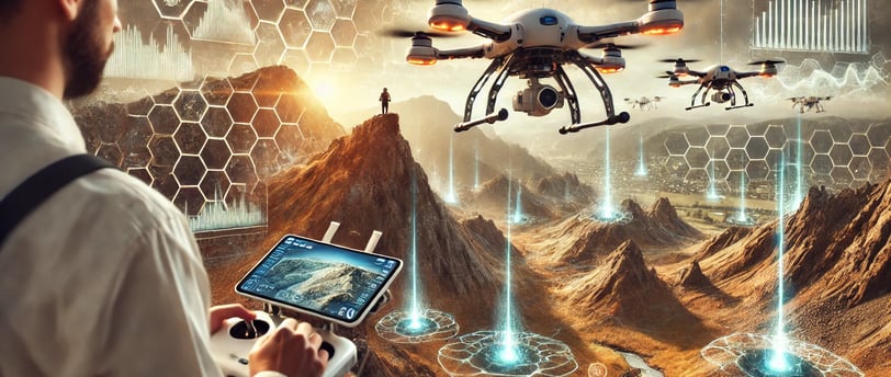
Drones Revolutionizing Geological Exploration
Discover how drones are transforming geological exploration by enhancing data collection, improving accuracy, and increasing efficiency, leading to advancements in earth sciences.
Jose Rendon
Introduction: The Flight of Ideas
The Earth, in its inexhaustible complexity, has captivated us since time immemorial. The traces of its geological past, landscapes shaped by underground forces, and even the way mineral and energy resources are distributed have been studied and admired since the first civilizations. However, geological exploration has always involved considerable challenges: long journeys, adverse weather conditions, heavy equipment, and extensive analyses. Today, thanks to the emergence of highly sophisticated drones, a true technological revolution is taking place in the field of geology. This revolution is expressed not only in the precision and efficiency of research but also in the way we conceive and understand the secrets hidden in our mountains, deserts, forests, and seas.
In this article, aimed at offering a broad and deep vision while being urban and socially relevant, we will explore how drones are transforming modern geology. We will present updated data, references to recent scientific research, and market trends to substantiate the importance of this topic. The goal is for both subject matter experts and curious readers passionate about innovation to delve into the newest frontier of geological science. Throughout this extensive journey, we will reflect on the history, present, and future of geological exploration with drones, maintaining a commitment to originality and informative interest expected of a quality publication.
1. Historical Context: From Maps to Imaginary Flights
For centuries, the study of the Earth was an epic task often akin to the adventure of an intrepid explorer. Cartographers and geologists of yore relied on rudimentary maps, compasses, and mechanical tools to unravel the shape and composition of mountains and valleys. Consider, for instance, 19th-century explorers who embarked on grand expeditions, traversing jungles and mountain ranges to hand-draw the first topographic representations. These cartographies, although fundamental at the time, were riddled with inaccuracies and conjectures, as the Earth revealed itself more slowly than today.
The advent of aerial photography in the mid-20th century marked a significant step forward in understanding the Earth's surface. Airplanes equipped with special cameras allowed a bird’s-eye view of regions previously difficult to access. However, these initiatives were expensive and often required collaboration with military forces or large institutions. In the 1970s and 1980s, the development of satellites ushered in the era of remote sensing: large-scale images offering increasingly precise details of the Earth, applied not only to geology but also to meteorology and environmental management. Even so, the resolution of these images was not always ideal for detailed geological studies in specific areas.
It wasn’t until the late 2000s, with advancements in electronic miniaturization and technological innovation, that the first unmanned aerial vehicles—commonly known as drones—with stable flight capabilities and high-resolution cameras began to emerge. Initially used mainly for military or surveillance purposes, the civil industry soon recognized their potential. For geological exploration, the possibility of having a “flying camera” maneuverable almost anywhere, without an onboard pilot, and at a relatively low cost, represented a radical shift. Today, this technological seed has borne incredible fruit.
2. The Present: Unlimited Potential for Modern Geology
The adoption of drones in geology is growing exponentially. A 2022 report by consultancy MarketsandMarkets estimated that the global drone services market—including industrial, agricultural, and environmental applications—would reach nearly $45 billion by 2025, a figure adjusted in 2023 to over $63 billion with the inclusion of emerging sectors like renewable energy exploration and underwater mining. This boom has not gone unnoticed in geology, where the demand for accurate data in less time and with greater safety is crucial.
A study published in Remote Sensing in 2023 by geologists from Stanford University and the Technical University of Munich highlighted that using drones in geological mapping could reduce field time by up to 40% compared to traditional methods. This translates not only to resource optimization but also to less human exposure to natural hazards, such as rockfalls, avalanches in mountainous areas, or accidents in unstable terrain.
Equipping drones with various sensors (multispectral, thermal, LiDAR, magnetometers, etc.) significantly broadens their scope. For example, in mining explorations, drones with magnetic sensors can fly over a region to detect geophysical anomalies indicative of mineral deposits without deploying large prospecting crews to the field. In the oil industry, multinational companies like BP and Shell are already using drones for 3D mapping of sedimentary basins and identifying structures favorable to hydrocarbon accumulation. Even in fields as specific as volcanology—where the risk of approaching an active crater is extremely high—drones provide real-time gas and temperature data, something unimaginable just two decades ago.
3. Key Technologies: From Photogrammetry to LiDAR
Among the main technologies enabling this revolution are high-resolution photogrammetry and LiDAR (Light Detection and Ranging) remote sensing. Photogrammetry involves obtaining precise measurements and maps from aerial photographs. A drone equipped with a high-resolution camera flies over the area of interest, capturing multiple overlapping images. Later, using complex computer vision algorithms, a three-dimensional terrain model with centimeter-level precision is created. This allows for the identification of geological formations, faults, stratifications, and other structural features with detail that previously required weeks or even months of fieldwork.
On the other hand, LiDAR technology uses laser pulses to measure distances and generate point clouds that describe the topography with extreme precision. For geology, LiDAR is particularly valuable in areas with dense vegetation, as the laser pulses penetrate much of the plant cover and reflect the underlying terrain structure. This means that even when a drone flies over a forested area, LiDAR can “see” the ground, revealing fractures, mounds, or depressions that would not be visible to the naked eye.
For example, in a 2021 project led by the University of British Columbia in Canada, researchers used a LiDAR drone to analyze retreating glaciers in the Peruvian Andes. They detected instabilities in the glacier walls that would not have been identified with conventional methods, alerting local communities to the need for preventive measures against potential avalanches or icefalls. This type of application highlights the scientific, humanitarian, and risk management significance that drone technology brings to modern geology.
4. Relevant Applications: From Mineral Discovery to Risk Monitoring
4.1. Exploration of Mineral Resources
One of the main drivers of drone use in geology is undoubtedly the mining industry. The growing demand for minerals—especially those critical for the energy transition, such as lithium, cobalt, and rare earth elements—has prompted companies worldwide to seek more efficient prospecting methods. Traditionally, ground teams equipped with magnetometers, gravimeters, and other measurement tools traversed large areas on foot. Today, a single drone can perform a magnetic survey of an area spanning tens of square kilometers in just a few hours, storing gigabytes of data ready for digital analysis.
Furthermore, 3D mapping obtained through photogrammetry or LiDAR helps delineate key geological structures with greater precision, optimizing the placement of drilling and sampling sites. According to the Society of Economic Geologists (SEG), the use of drones could reduce initial exploration costs by up to 25% and accelerate preliminary studies by up to 35%, directly impacting the competitiveness of mining companies.
4.2. Assessment of Geological and Geotechnical Risks
Another field where drones have seen notable growth is in the evaluation and monitoring of natural risks, such as landslides, rockfalls, and volcanic activity. In 2022, the journal Nature Geoscience published an article highlighting the work of Japanese and Chilean scientists who used drones to map fissures and faults near the city of Antofagasta, on Chile's northern coast, known for its seismic activity. Thanks to the millimetric precision of the topographic data collected, they identified areas susceptible to future collapses, guiding urban safety policies and the implementation of contingency plans.
In geotechnics, drones have become allies in the supervision of slopes on roads, dams, and retaining walls. With a programmed flight, a 3D model of the slope can be obtained in minutes and compared to previous measurements, assessing volume changes, emerging fractures, or dangerous water accumulations. For infrastructure authorities, this information is vital to anticipate risks and prevent large-scale disasters.
4.3. Monitoring of Volcanoes and Geothermal Activity
In volcanology, the adoption of drones has had a major impact, as it significantly reduces human exposure to hostile environments like active craters. Drones equipped with thermal cameras can measure lava temperatures, detect gas emission zones, and map pyroclastic flows even at night or under dense smoke conditions. These measurements, processed through geospatial algorithms, help model the magmatic feeding system and estimate the possible evolution of the eruption.
A recent example occurred during the eruption of Fagradalsfjall volcano in Iceland in 2021 and 2022. There, geologists from the Icelandic Meteorological Office and the University of Iceland conducted daily drone flights to record variations in the lava field, gas emissions, and associated seismic activity. They generated high-resolution 3D maps that, combined with seismological data, allowed them to create a fairly accurate predictive model of the eruptive evolution. This enabled them to issue timely alerts about possible increases in activity and to provide updated information to the media, protecting both residents and tourists.
5. University Research and International Collaborations
Drones are not just tools for industry; they have also opened promising paths in academic research. Many universities around the world have established remote sensing laboratories, equipping them with fleets of drones of various sizes and capabilities. These laboratories often collaborate with public institutions, non-governmental organizations, and private companies, creating multidisciplinary networks.
Take, for example, the University of Leeds in the United Kingdom, where a group of geologists and engineers established the Drones for Earth Science Lab (DESL), specializing in applying drones to sedimentology, geomorphology, and climate change studies. According to statements by Dr. Emily Farnum, project leader, in 2023 they managed to map the Tinto River basin in southern Spain, known for its conditions analogous to Martian environments, to understand iron mineral oxidation processes. By combining LiDAR drone flights with geochemical laboratory analyses, they traced high-resolution mineral alteration profiles and studied how extreme conditions might exist on other planets.
Similarly, the National Autonomous University of Mexico (UNAM) has conducted drone projects to evaluate aquifers in desert regions of northern Mexico, using hyperspectral cameras to detect vegetation reflectance as an indirect indicator of underground moisture. This line of research, developed by Professor Juan Carlos Ramírez's team in 2022, aims to identify areas that could harbor freshwater reserves, which are extremely valuable in regions experiencing water stress. If these prospects are confirmed, sustainable development plans and responsible resource use strategies could be implemented, avoiding the overexploitation of wells.
6. Technical and Ethical Challenges
Despite global enthusiasm for drone use in geological exploration, there are considerable challenges that require critical and ethical approaches. One of the first challenges is airspace regulation. Not all countries have clear regulations allowing drones to fly in remote areas without restrictions, and in many cases, the bureaucracy to obtain permits can delay projects. Additionally, in remote or high-risk areas (e.g., active volcanic zones), strict safety protocols are necessary for the pilot and team.
From a technical perspective, flight autonomy remains a limiting factor. Although battery technology has significantly improved in recent years, many drones’ flight duration still ranges between 20 and 40 minutes, depending on the sensor payload. This limits coverage of larger areas and requires planning multiple flights or using larger drones, which demand a higher budget and greater expertise.
In ethical terms, over-collection of data and its irresponsible handling raise concerns. Who stores the geological information collected? How is it used, and how is the privacy of individuals or communities living in the study area protected? Particularly in projects involving ancestral lands or culturally valuable sites (e.g., archaeological zones), there is a risk that the information will be used without local communities' consent or that it may promote the indiscriminate exploitation of natural resources. In this regard, ethical codes adopted by geological and engineering associations must be updated to include specific guidelines on drone use.
7. Future Perspectives: Toward the Consolidation of the Revolution
Given this outlook, it is almost certain that drones will continue to transform geology in the coming decades as sensor technologies and artificial intelligence progress. Many laboratories are experimenting with fully autonomous drones capable of planning their flight routes and adapting them in real-time based on terrain features or detected findings. Similarly, the miniaturization of sensors will allow smaller drones to be equipped with capabilities currently exclusive to larger models.
The development of solid-state batteries or even hydrogen fuel cells promises to extend flight autonomy beyond one hour, with plans for wireless charging systems at terrestrial stations distributed throughout study areas. This would enable continuous mapping, collecting massive amounts of data without constant interruptions.
In terms of data interpretation, the use of deep learning algorithms and cloud computing will automate much of the processing. Models are being designed to identify geological structures, distinguish lithologies, and predict the presence of minerals upon receiving drone-generated images or point clouds. Such artificial intelligence systems could drastically shorten the post-processing phase, which currently consumes significant time for teams of geologists and engineers.
Another trend many researchers are working on is the combination of drone data with high-resolution satellite observations, creating a multi-scale analysis system. Satellite images provide a general and continuous view over time, while drones complement this with specific details. This is crucial for mining and energy exploration projects in remote regions, as well as for monitoring volcanic or seismic activity.
8. Final Reflections: A Shared Future Between Earth and Sky
We might say that drones are our winged messengers, carriers of vital information arriving from above with the precision of a scientific lens. Drones in geology bring us closer to the social and historical realities intertwined with the Earth: the resources we extract are not merely economic assets but also part of our natural and cultural heritage. In this sense, technology does not operate in a vacuum but within a human and environmental context that demands sensitivity and responsibility.
The possibility of performing low-altitude flights over unexplored ravines, venturing into volcanic fog, or unveiling the hidden traces of ancient tectonic faults is not merely an engineering achievement. It is a bridge to deeper knowledge of our planet—a key that can unlock a renewed dialogue between science and society on the importance of understanding, valuing, and protecting our terrestrial home.
Conclusions and Call to Action
Geological exploration with drones emerges as a technological revolution that, far from being a fleeting trend, seems destined to become a fundamental pillar of contemporary geology. Numerical evidence and recent studies support its efficiency, precision, and ability to reduce human risks in hostile environments. From the mining industry and natural risk management to academic research and environmental conservation, the range of applications is nearly limitless. However, like any revolution, it carries obligations and responsibilities. Attention must be paid to regulations, data sovereignty, community autonomy, and professional ethics in resource exploitation.
As more companies, governments, and universities adopt drones, it is essential to do so with a horizon of sustainability and equity. As a society and as a planet, we cannot afford to repeat past mistakes that disconnected science from general well-being. On the contrary, the convergence of technological innovation with the ancestral wisdom of communities and today’s ecological awareness can lead to a renewed geology capable of fostering not only discoveries but also a more harmonious balance between development and conservation.
Ultimately, each drone flight is also a journey through geological history—a journey that connects us to the Earth's subterranean heartbeat, its volcanoes, mountains, and strata laden with memory. It is a privilege that, if properly harnessed, will lead us to a future where deep knowledge of our planet becomes the driving force to protect it and, in doing so, safeguard our own destiny as a species.
References and Recommended Reading
MarketsandMarkets Report (2022): Growth forecast of the drone industry in various sectors.
Farnum, E., et al. (2023). Integrated Drone-LiDAR in Sedimentological Studies, Journal of Geophysical Research.
Ramírez, J.C. (2022). Applications of Hyperspectral Detection in Arid Zone Aquifers, Latin American Geological Journal.
Nature Geoscience (2022): Collaborative study on geological faults in the Antofagasta coast.
Icelandic Meteorological Office and University of Iceland (2021-2022). 3D Cartography and Drone Monitoring of Fagradalsfjall Volcano.
Society of Economic Geologists (SEG, 2021). Report on Drones and Mining Prospects.
Resources
Explore geology and renewable energy here.
© 2024. All rights reserved.